WorldCereal Documentation
  1. Introduction
  2. How it all started
  • Welcome
  • Introduction
    • How it all started
    • Purpose and Scope
    • System Overview
  • Reference Data Module (RDM)
    • Overview
    • Reference Data Harmonization
    • Explore and Retrieve Data
    • Upload Your Data
    • Publish Your Data
  • Processing Module (PM)
    • Overview
    • Usage of the Cloud System
    • Usage of the Standalone System
  • Visualization and Dissemination Module (VDM)
    • Overview
    • Visualizing Global Products
    • Launch Processing Jobs
  • Support and Resources

On this page

  • How it all started
  1. Introduction
  2. How it all started

How it all started

Accurate estimates on cropped area, crop type distributions and irrigation practices play an important role in guiding policy decisions related to food & water security. In 2023, the WorldCereal consortium released the first set of high-resolution, global and season-specific cropland, crop type and irrigation maps for the year 2021, thereby demonstrating both the scientific and technical feasibility of such a challenging undertaking.
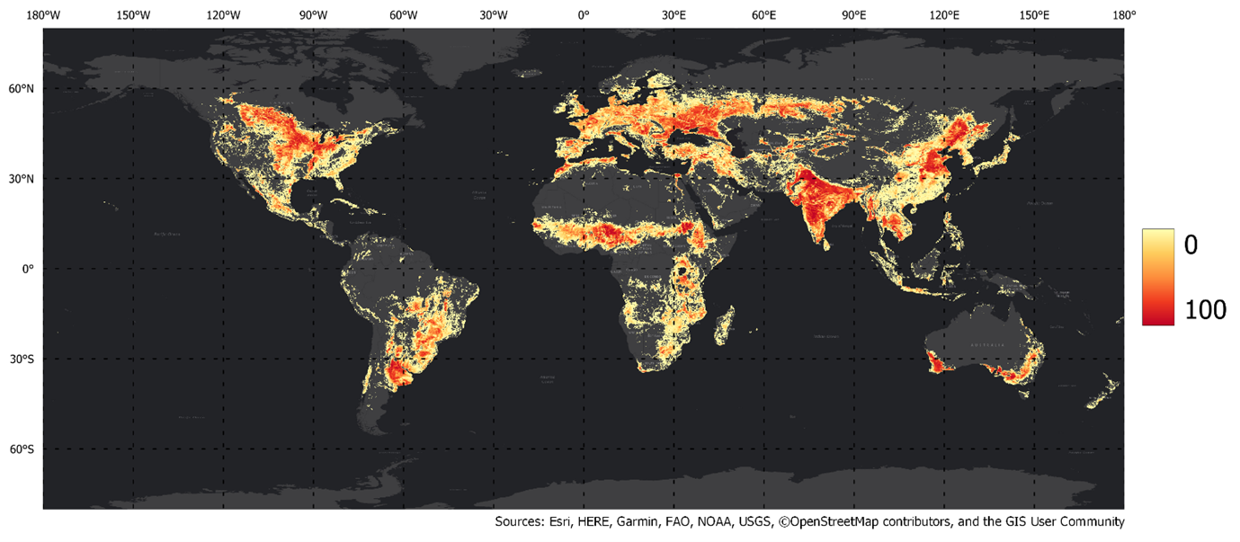
WorldCereal 2021 temporary crop extent map, resampled to ~0.004 ° resolution. Each pixel contains a number between 0 and 100, indicating the fractional cover of temporary crops within that pixel.

Based on the success of this first phase of the project, the consortium now continues to open up the processing system to the world, powered by the Copernicus Data Space Ecosystem and OpenEO.

Discover more about the specific objectives and activities of this second phase of the project.

Welcome
Purpose and Scope